Cerro Alto

Cerro Alto

Cerro Alto. Highway 41. Halfway between Morro Bay and Atascadero, but any address I could find called it Morro Bay. Los Padres National Forest. Hike begins at the campground. $5 to park.

Cerro Alto

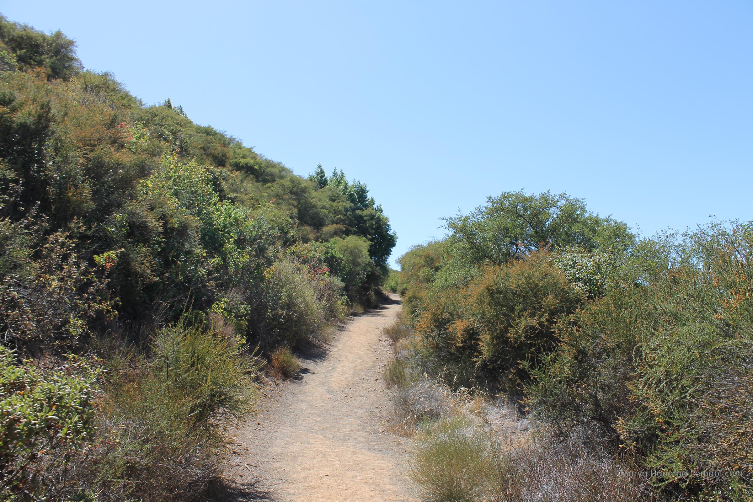
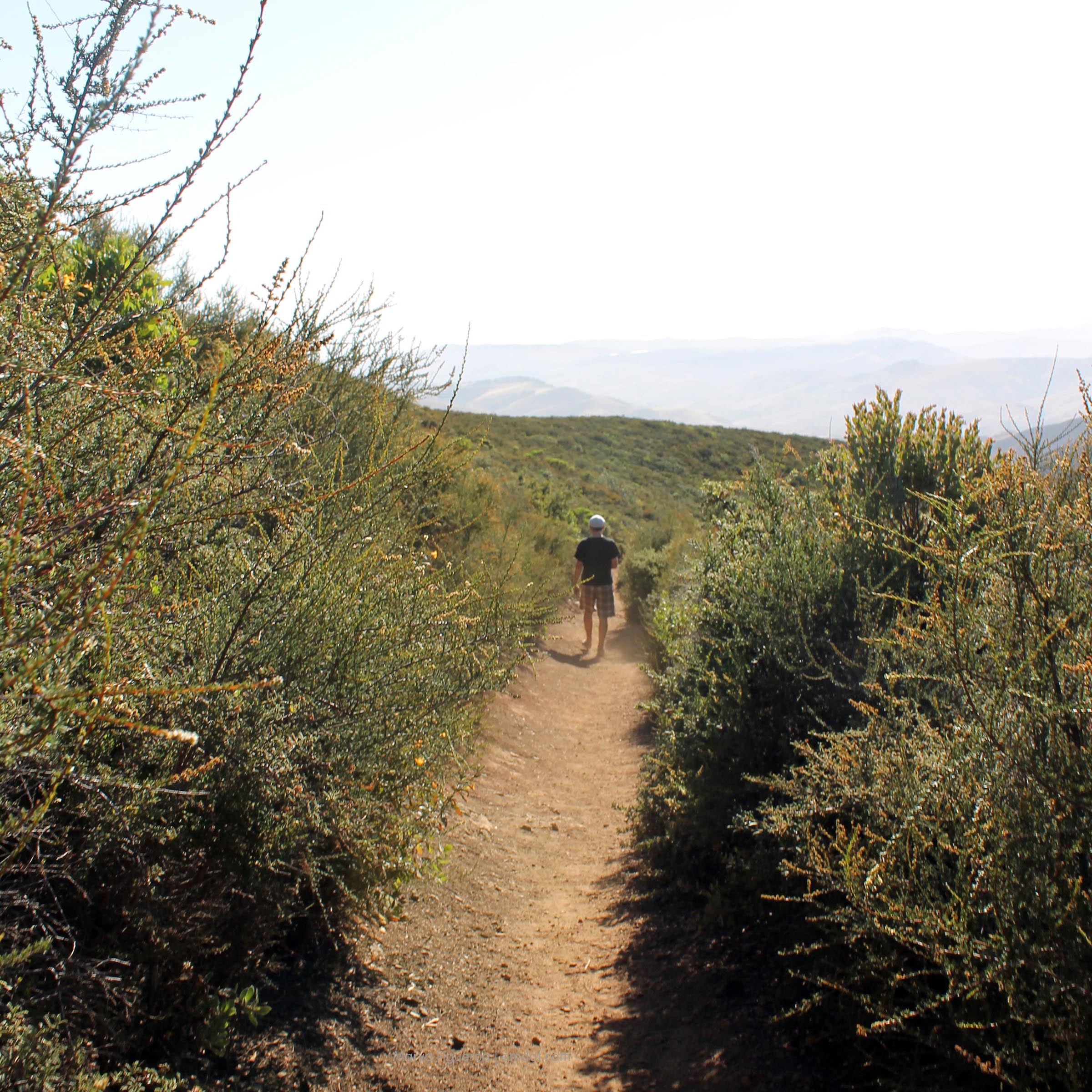
In the summer it’s a hot and dusty trail, so bring water. Bring sunglasses. Bring a hat. Bring your patience because the trail is steep. And/or I’m not in the shape I wish I was in yet.

Cerro Alto

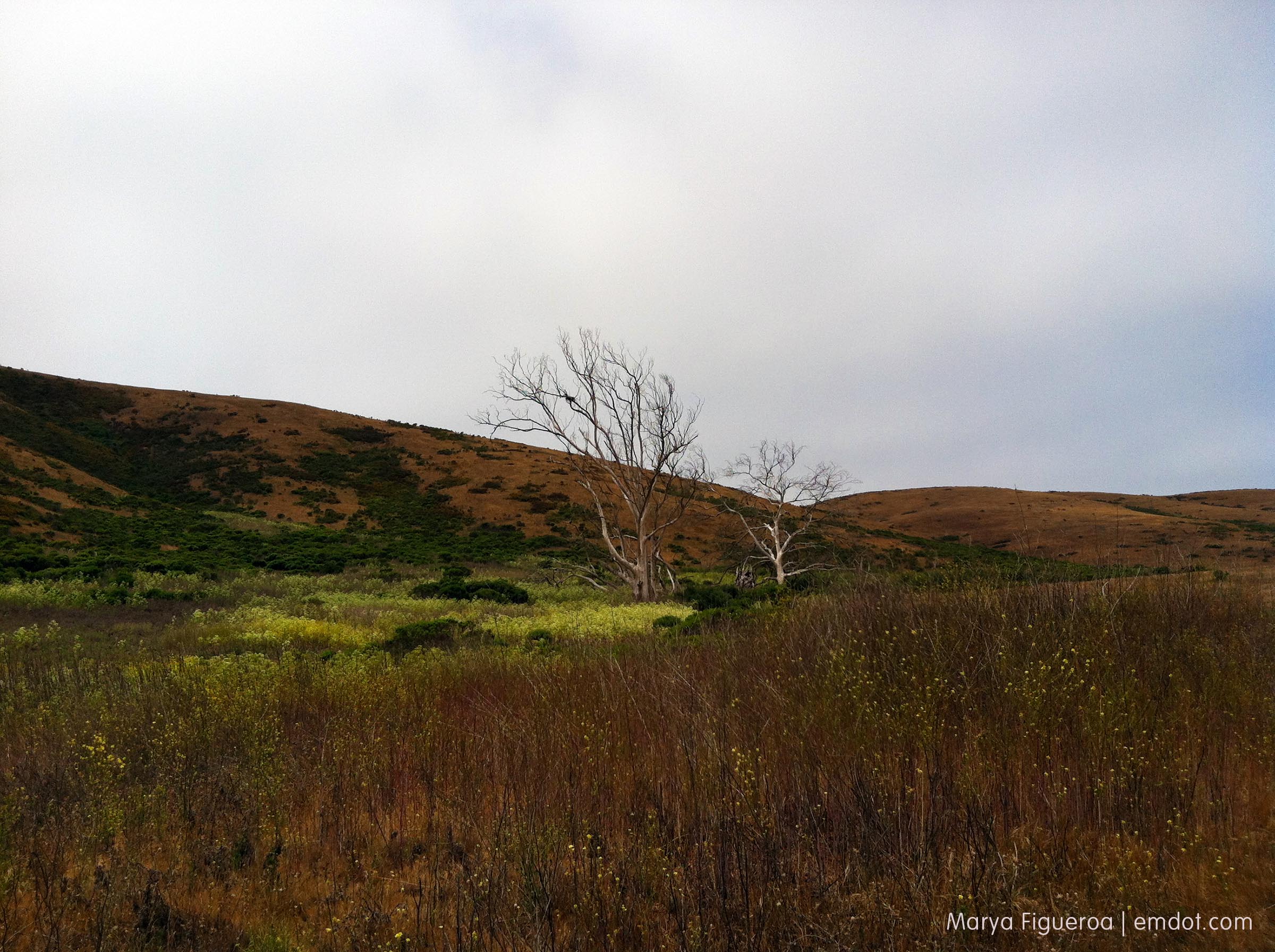
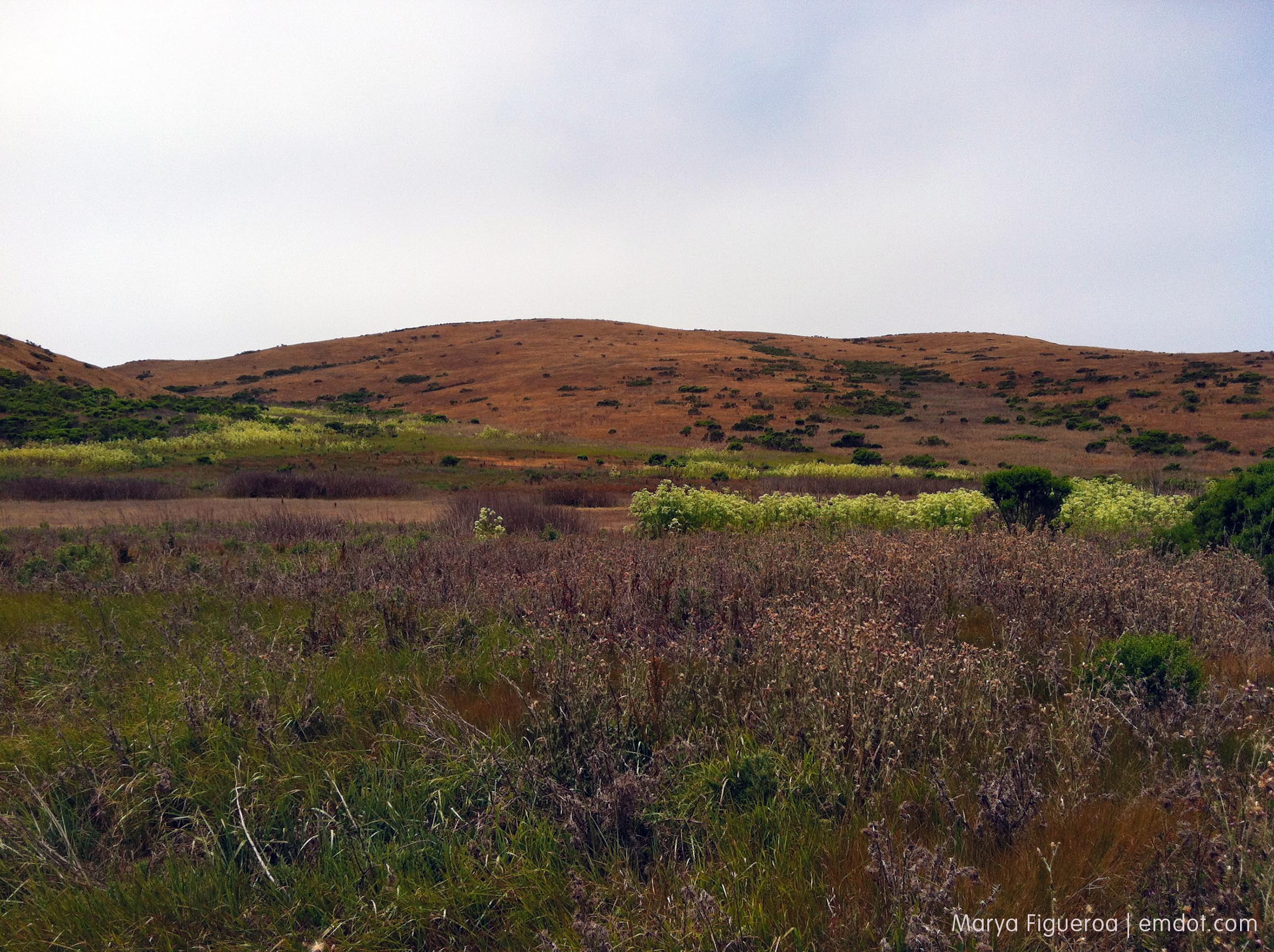
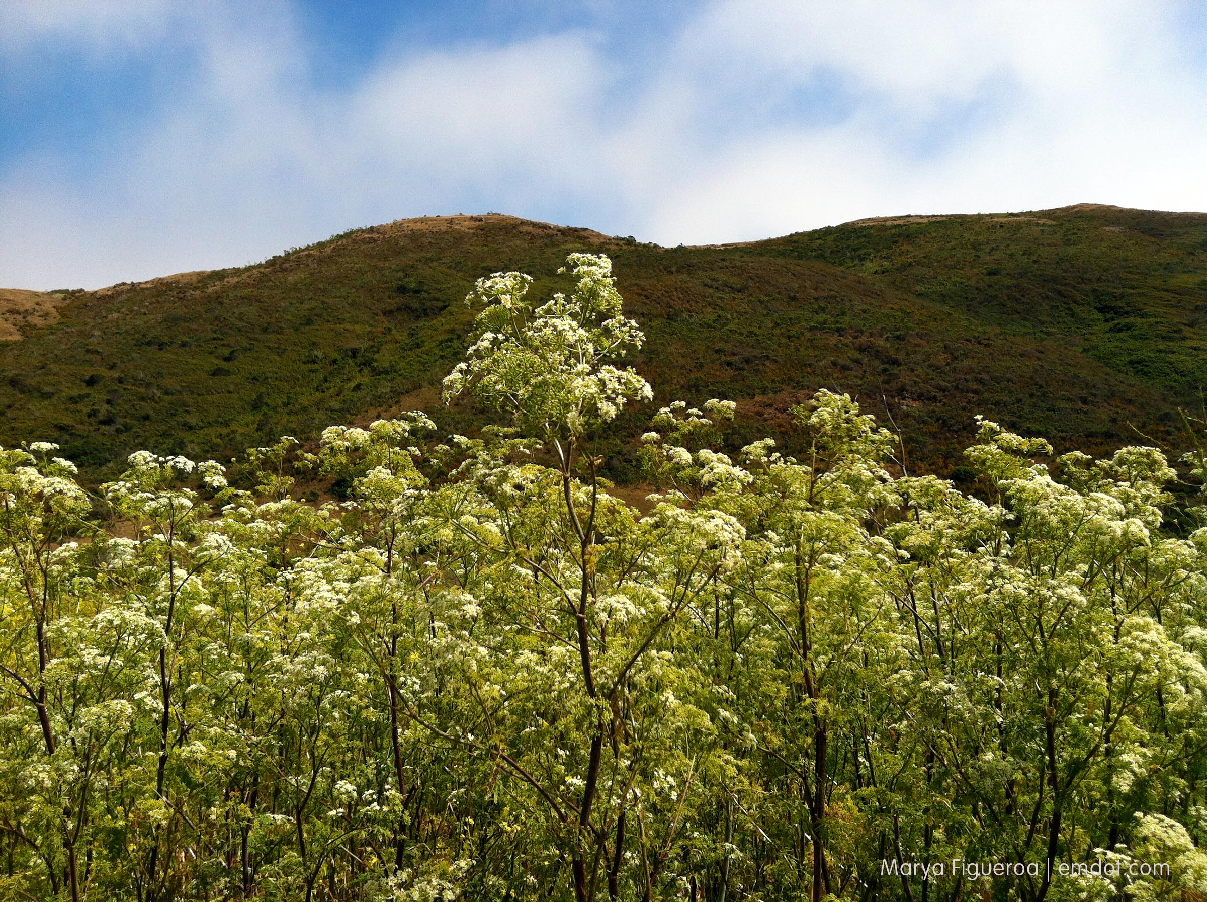
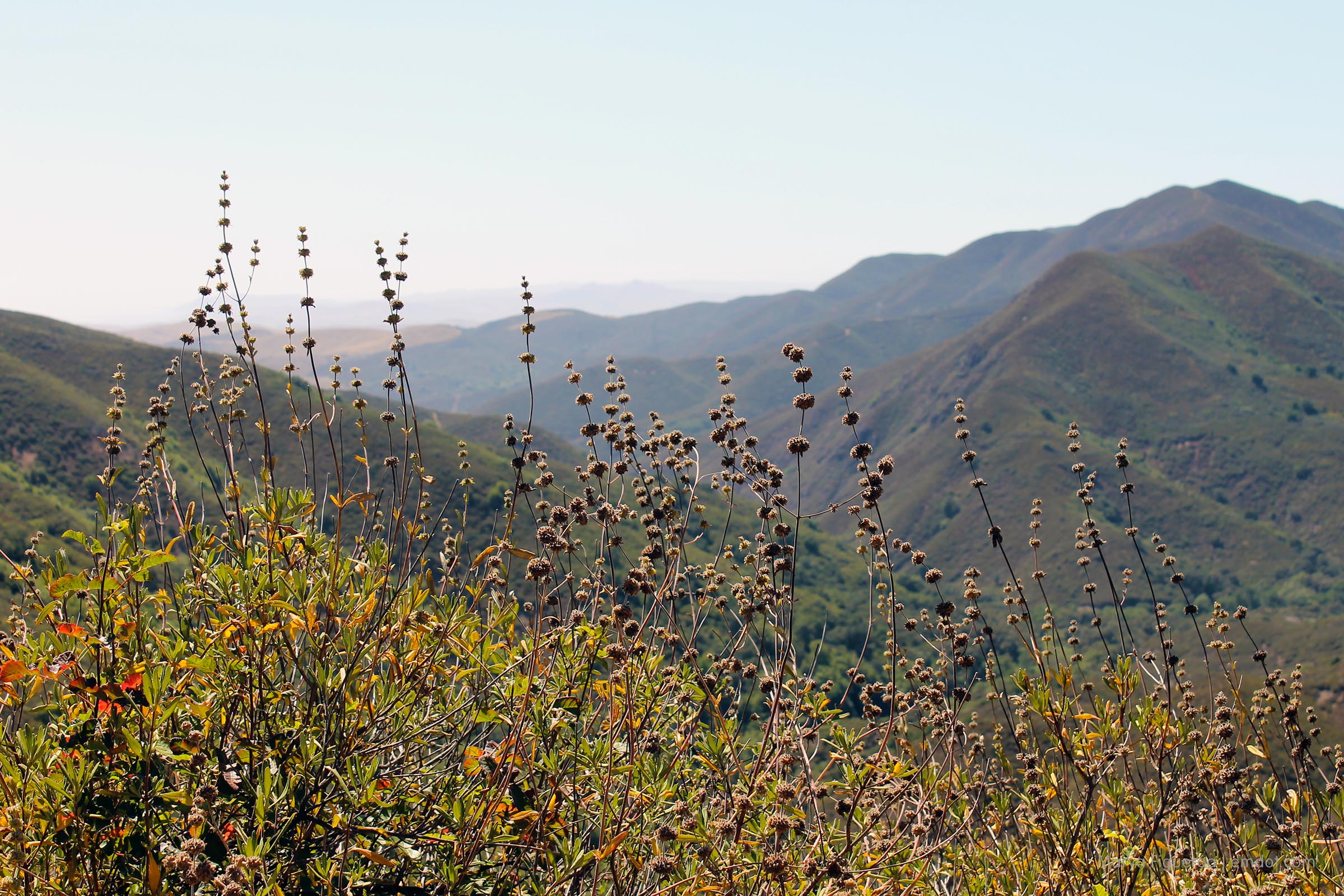
The black sage is dried out now. Still lovely if not lush.

Cerro Alto

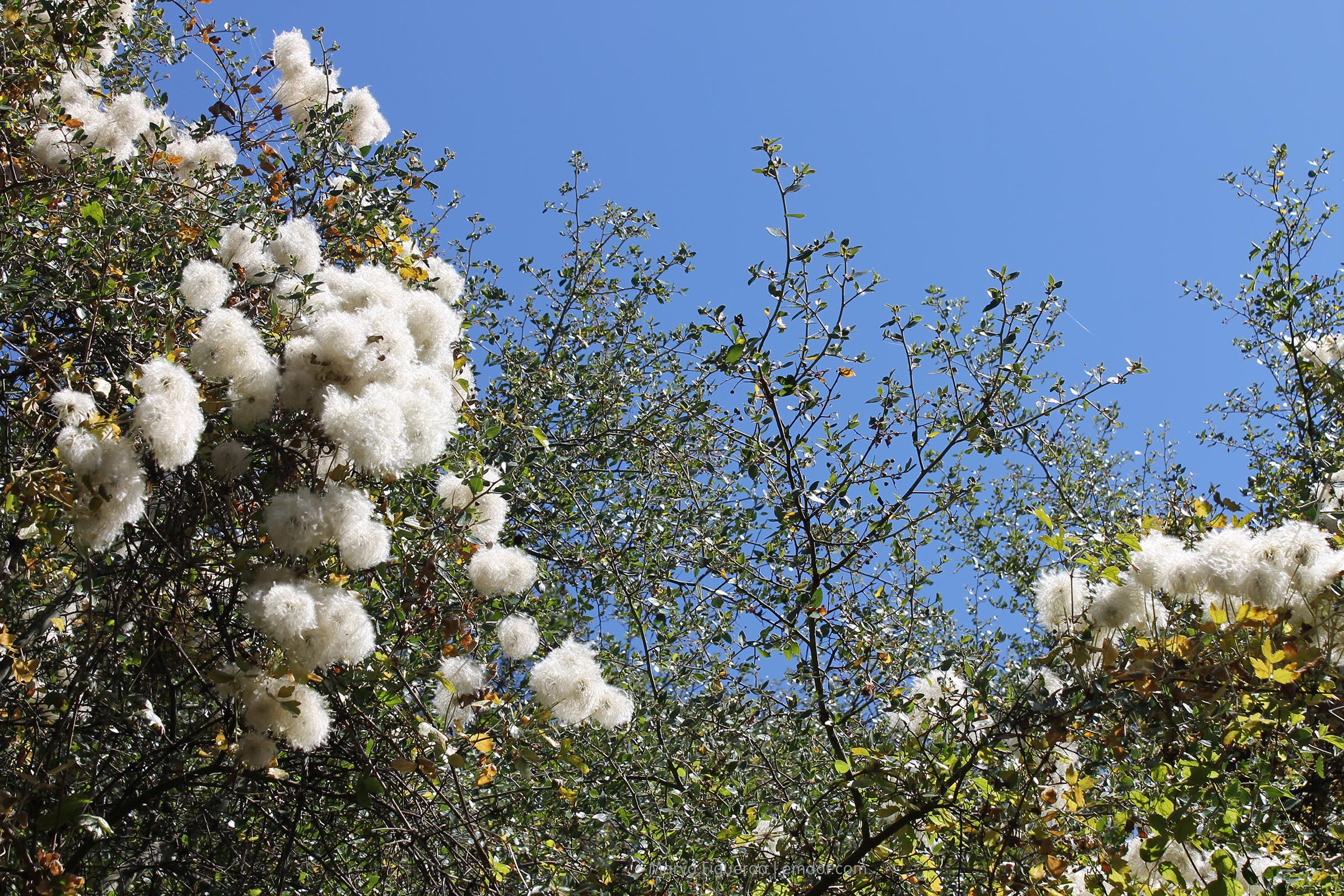
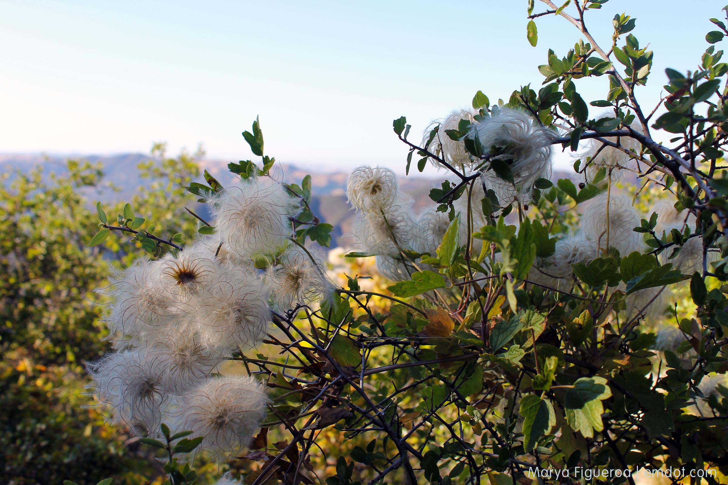
I learned a new plant on the hike: clematis, a tenacious vine. These are seed pods and they were often way up high and overhead. Dr. Suessian type of fluffy balls. One of my friends said you should be able to put lights inside. That would make for a lovely evening hike.

Cerro Alto

clematis

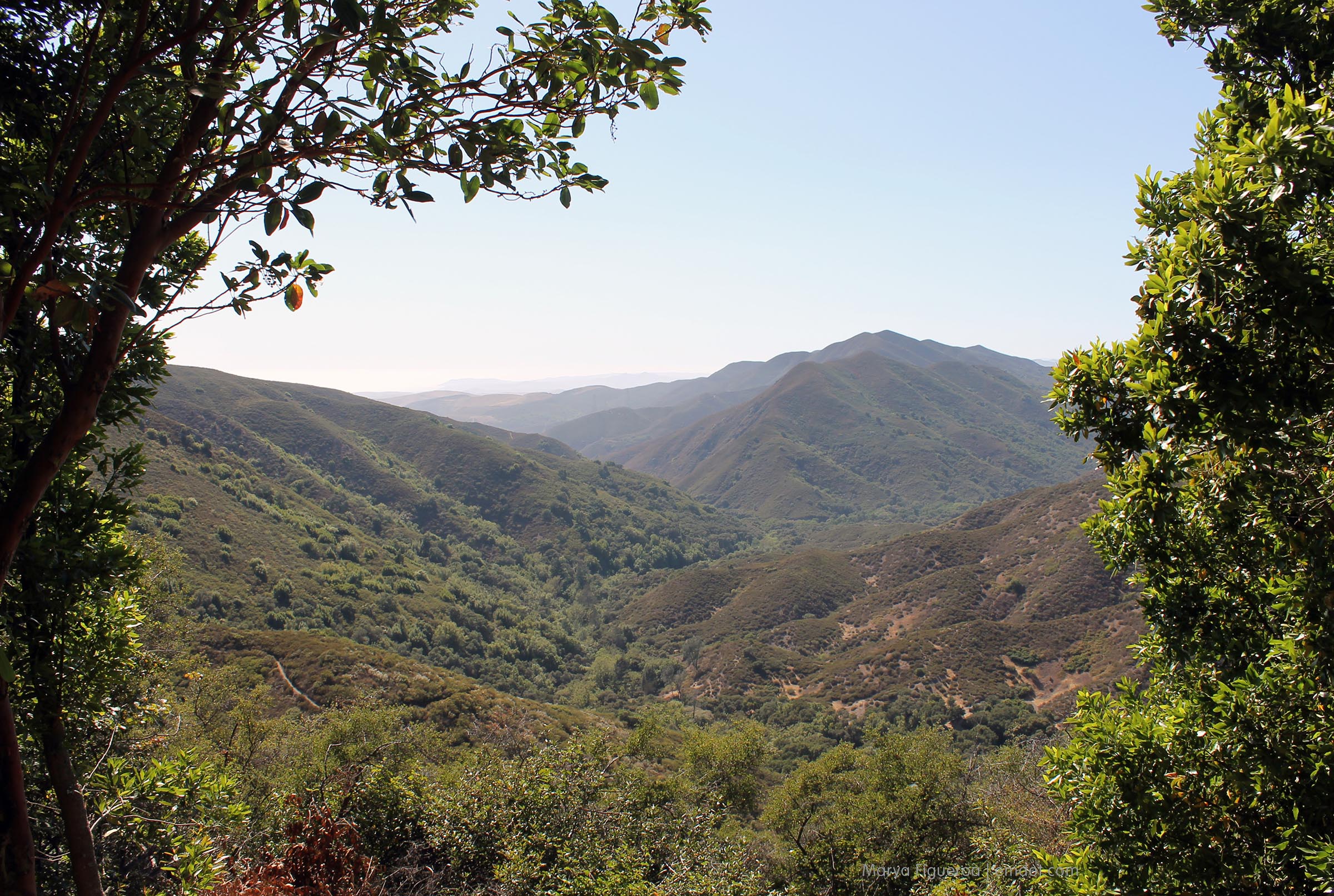
There is a bench right here. As it is about halfway up and in the shade in the afternoon, this is a nice place to sit, catch your breath and stare out towards the ocean.

Cerro Alto

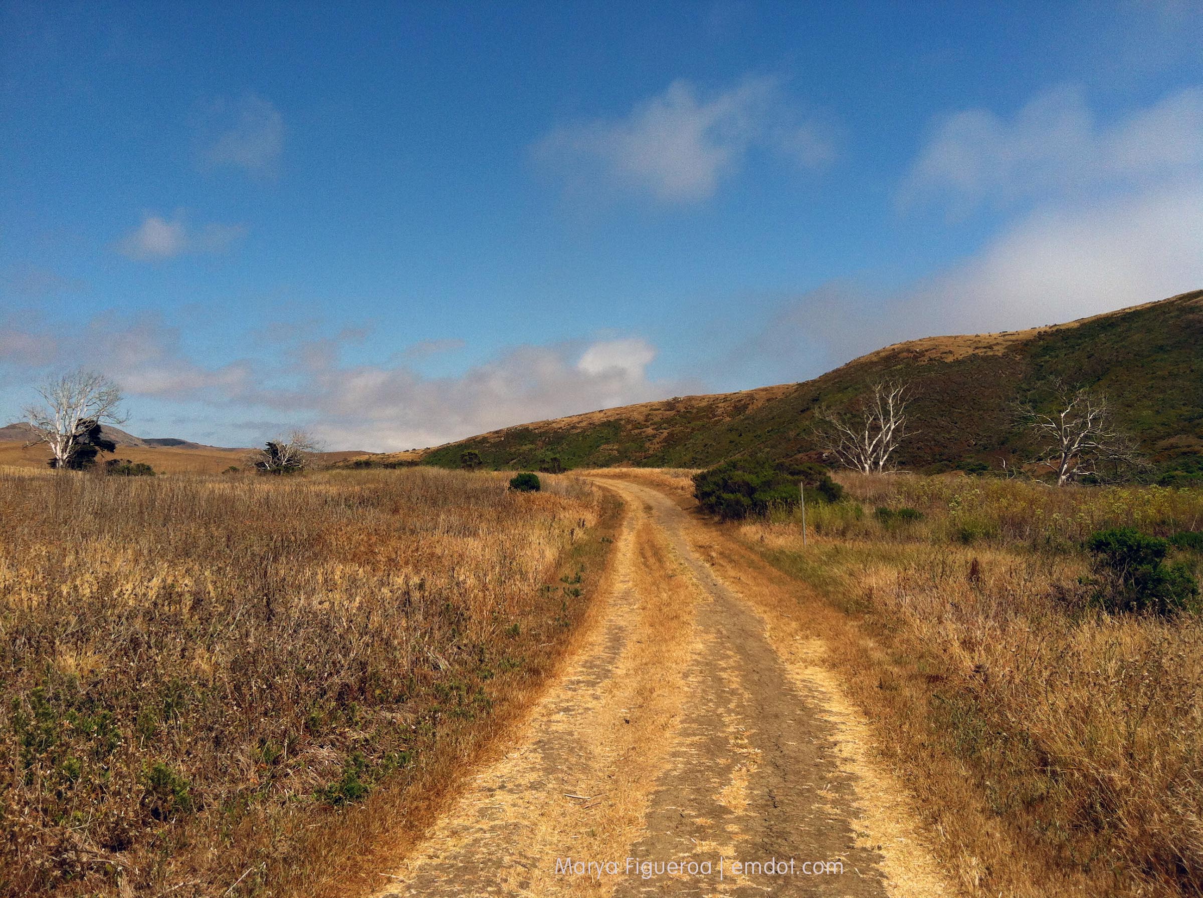
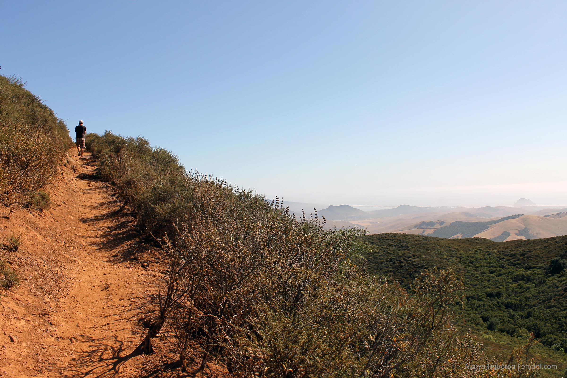
The trail is steep. I know I said it before. It bore repeating.

Cerro Alto

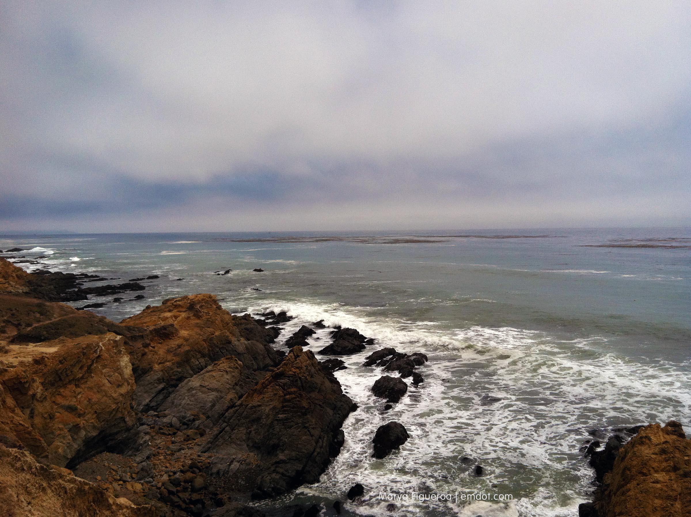
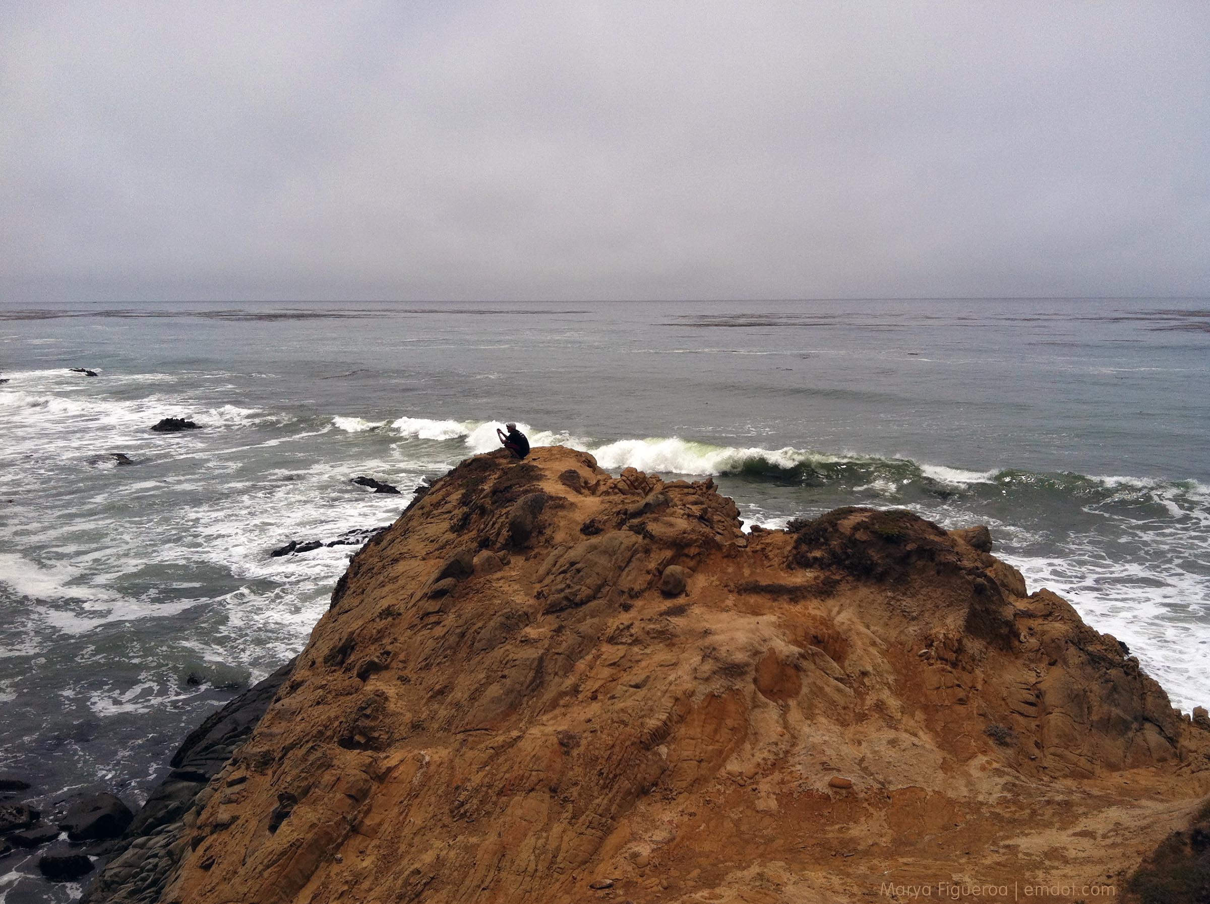
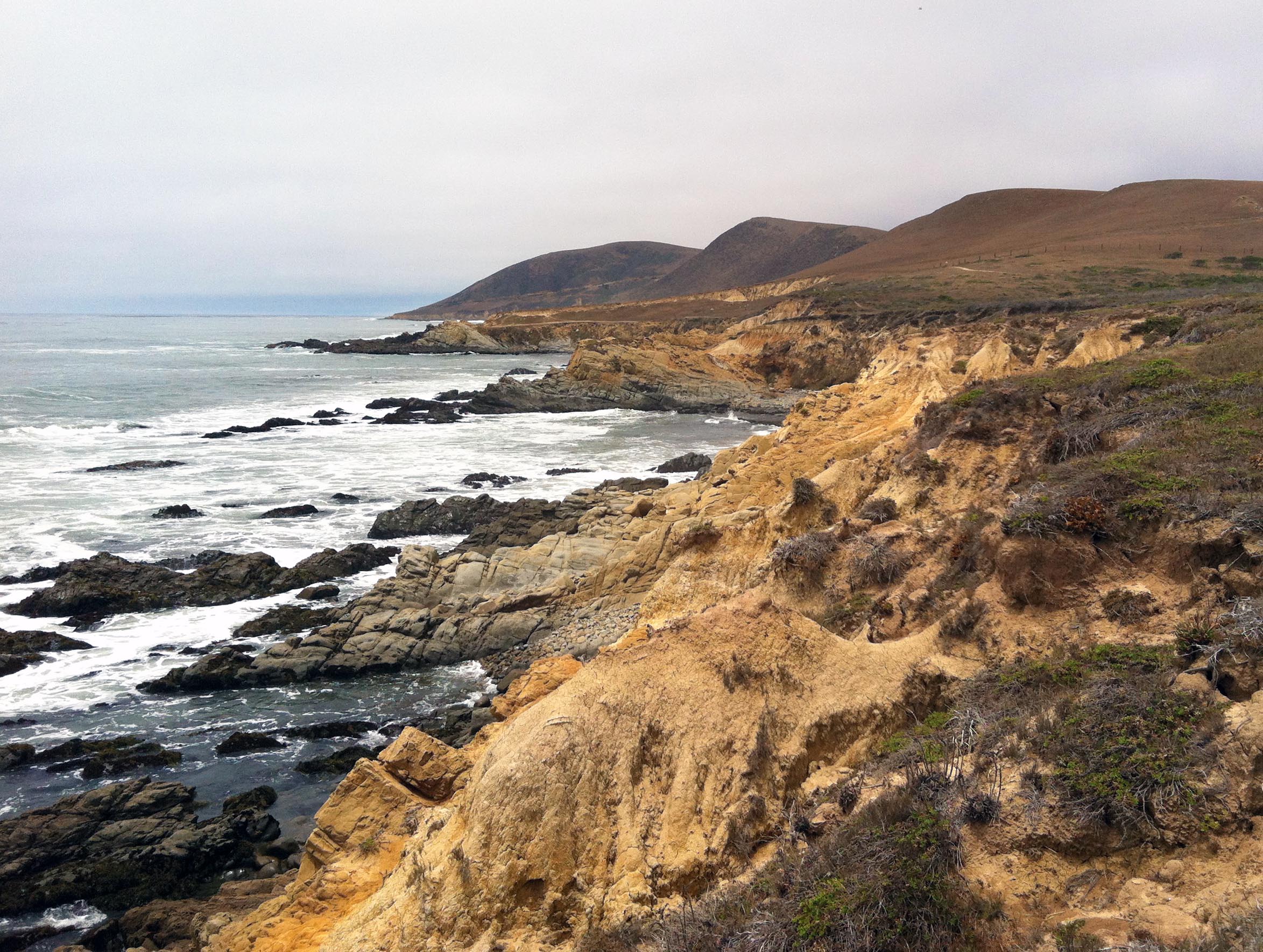
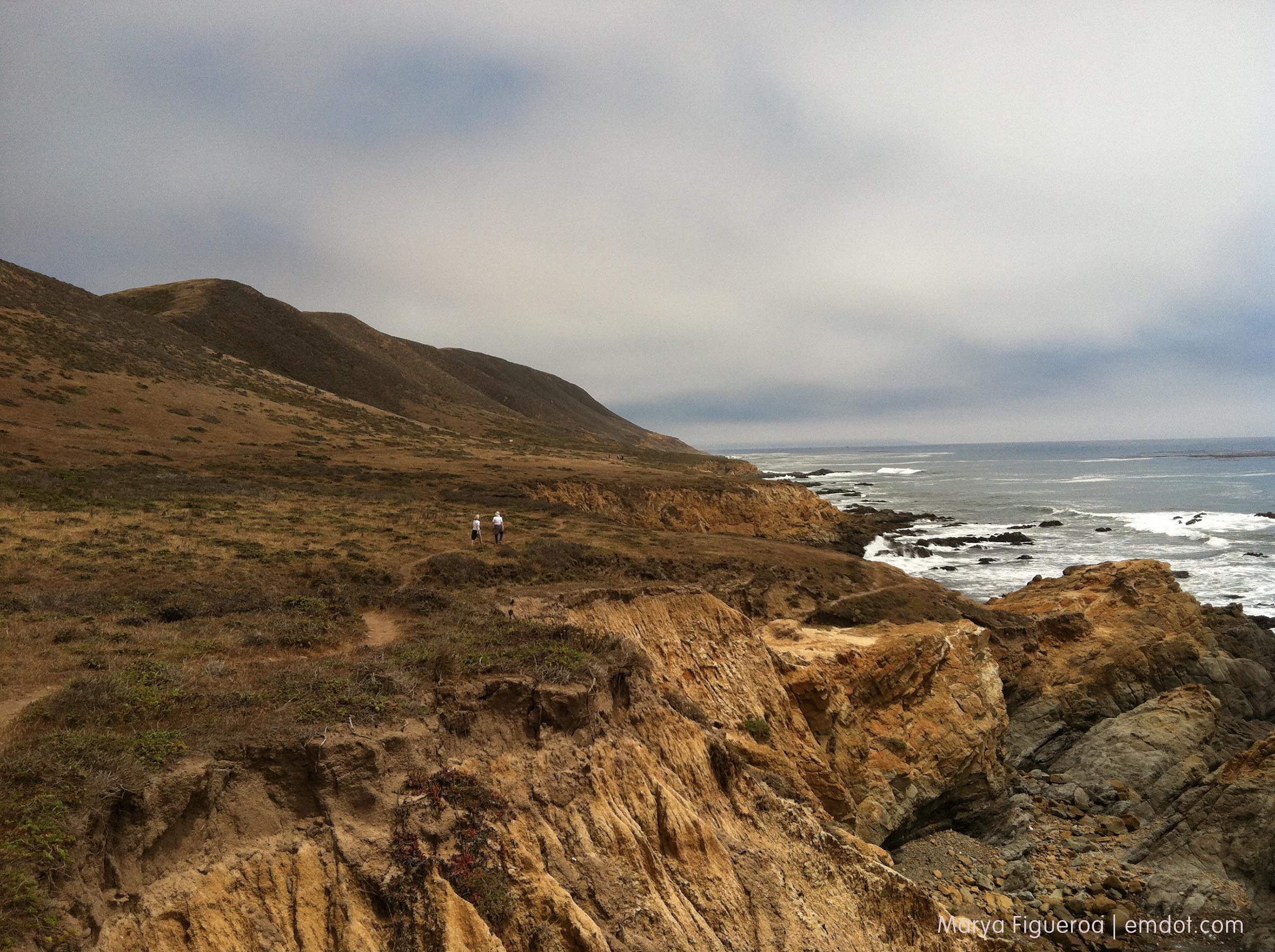
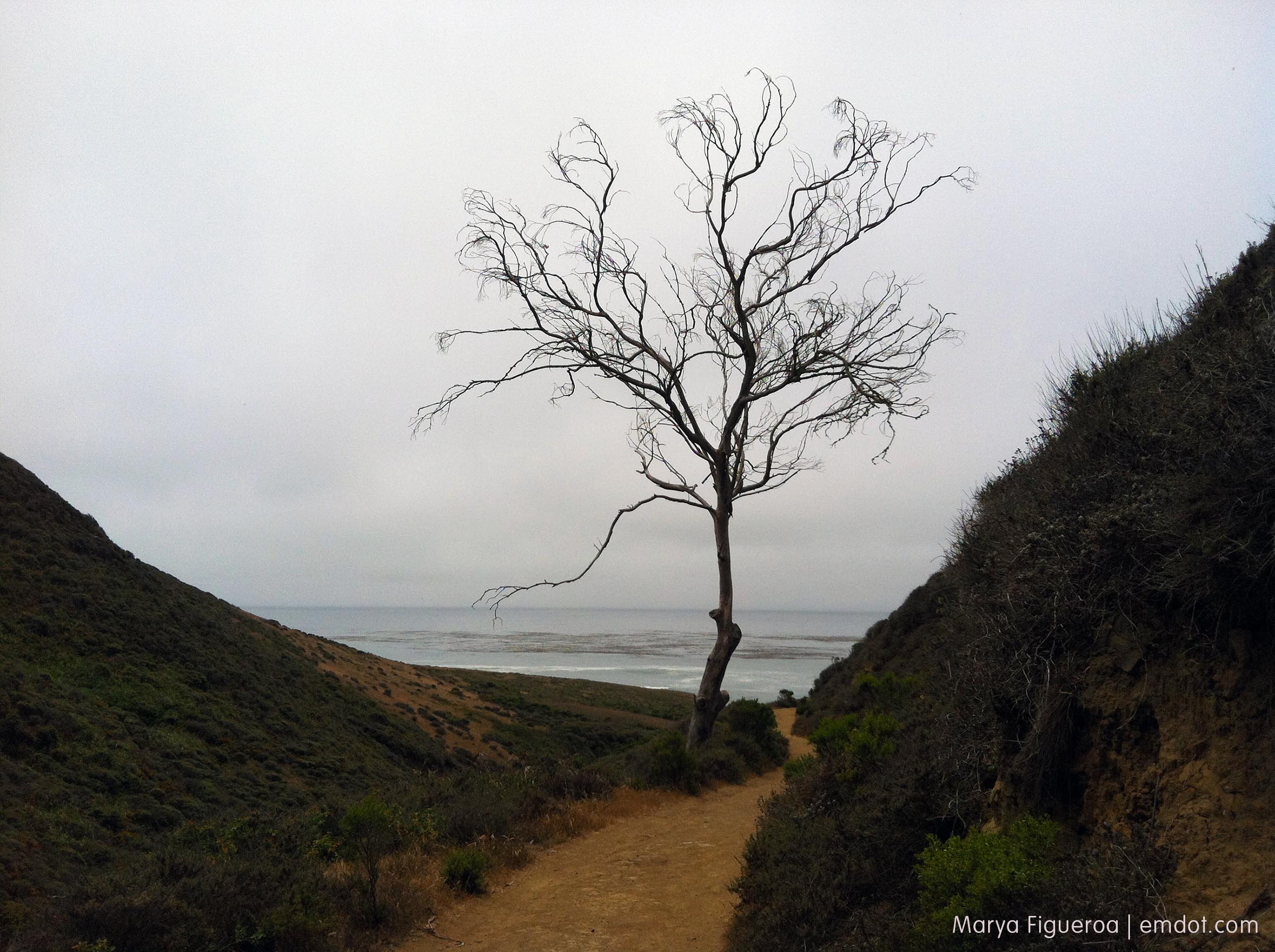
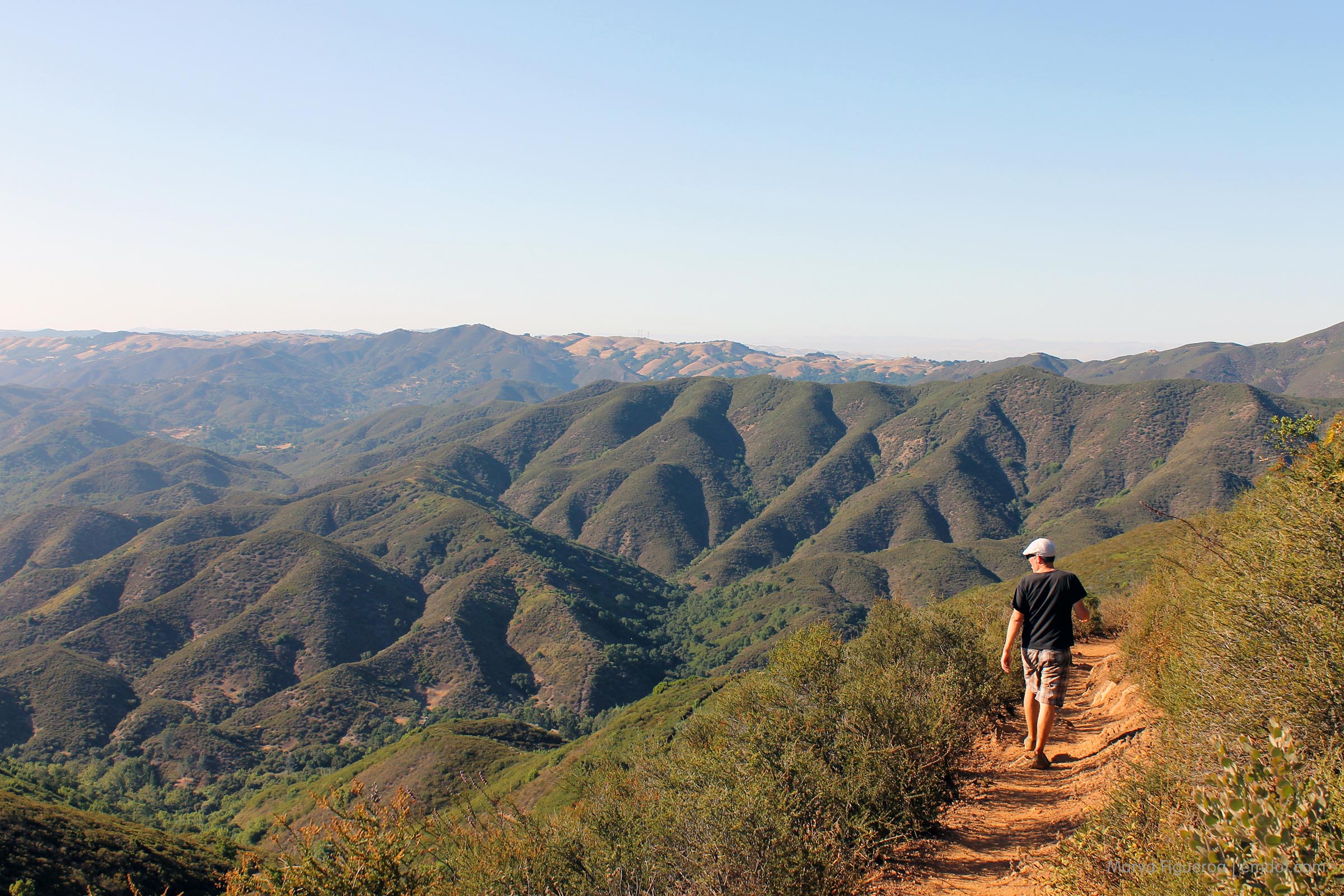
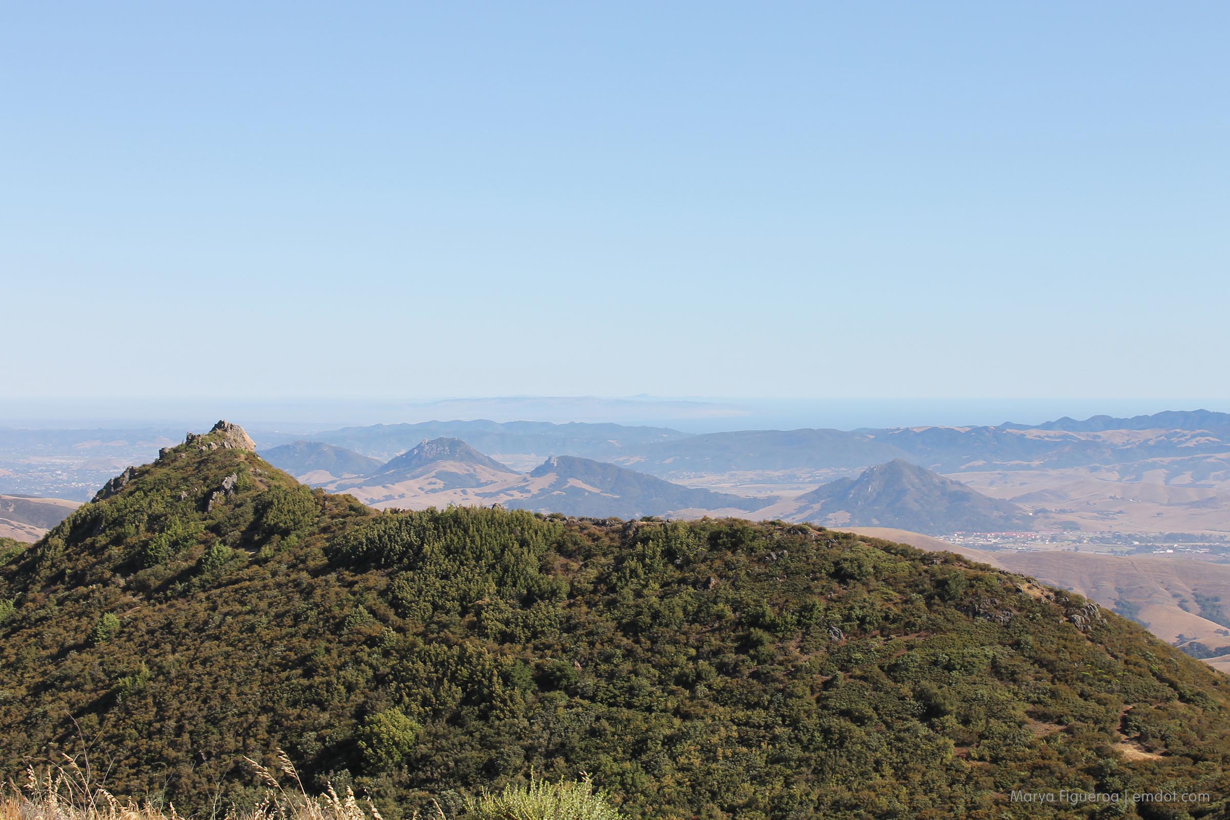
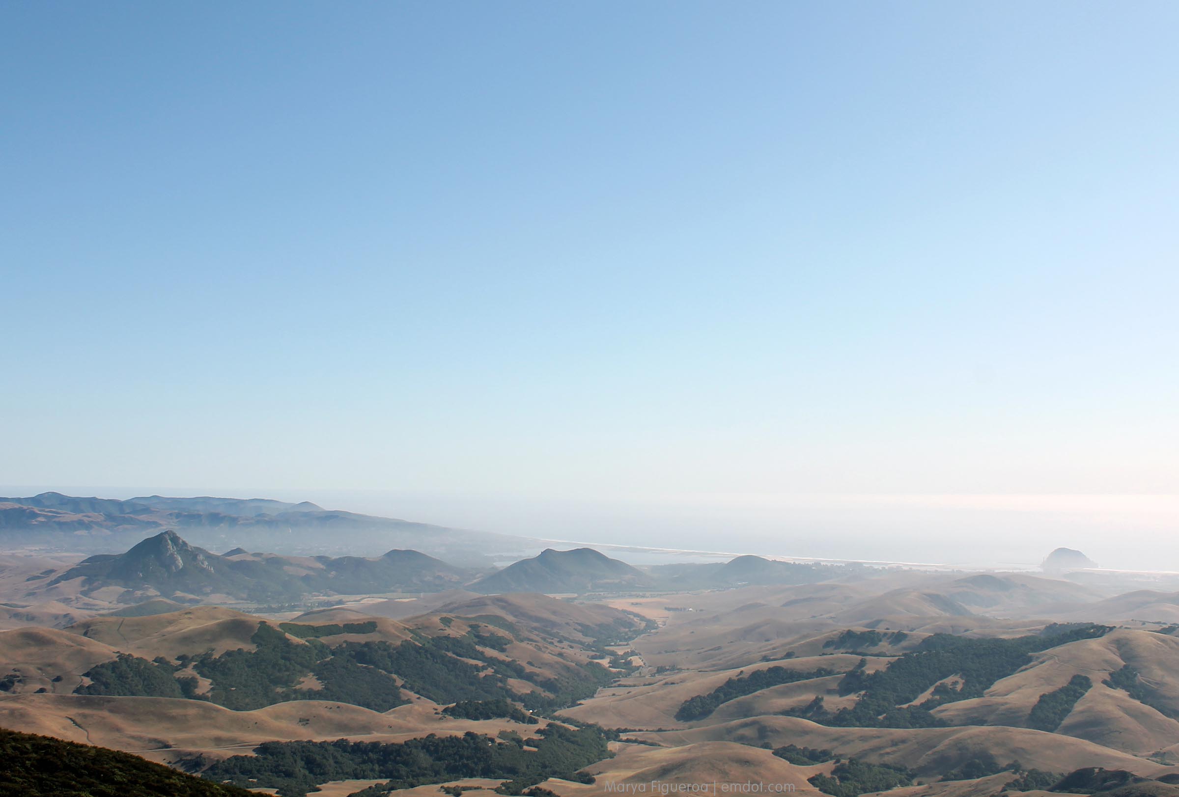
The views at the top are something else. I was really tired and pretty dehydrated at this point (I didn’t bring enough water; I didn’t wear a hat.) and I think it left me too pooped to take a decent photo because these surely do not do it justice.

From the top I could see five hiking spots I’ve done since Peak a Week started: Cerro San Luis, Bishop Peak, Valencia Peak, Black Hill and Harmony Headlands. And I could see two of the beaches I’d visited since Beach a Week started: Morro Strand/A Beach and Cayucos. Actually three — you can see Pismo as well.
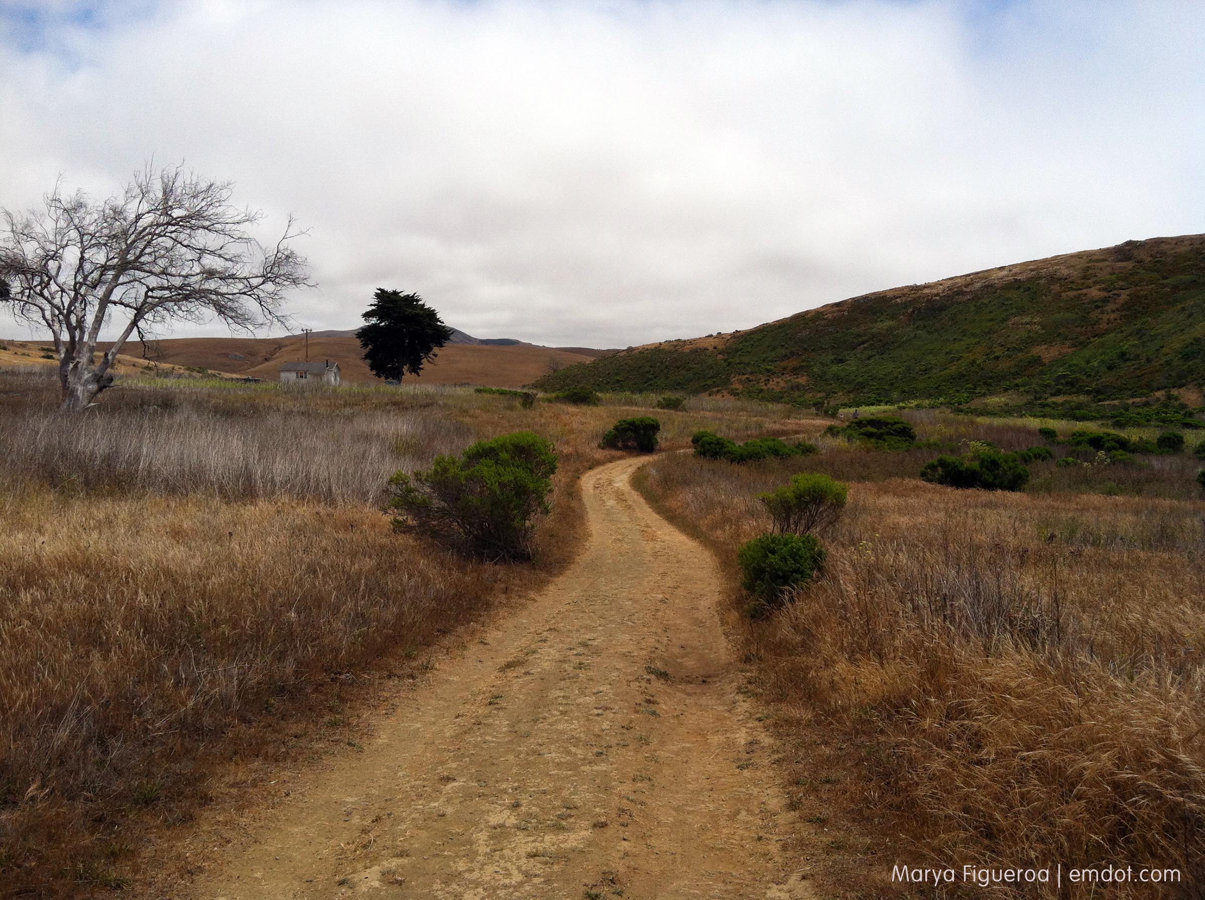
Cerro Alto

Cerro Alto

Heading back down.

Cerro Alto

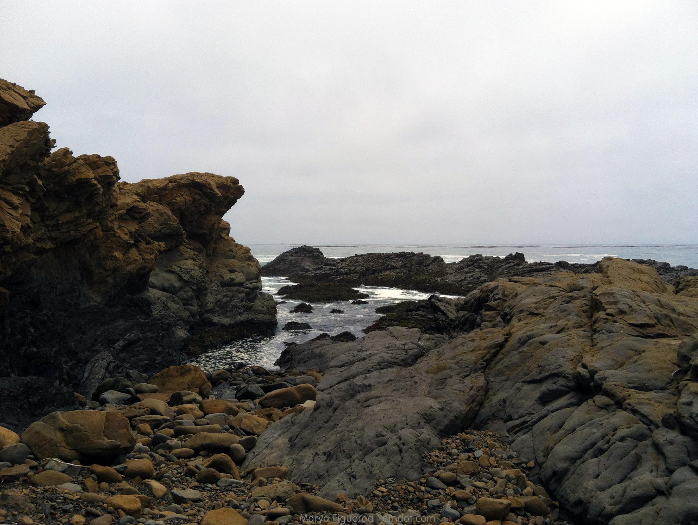
The red splotches you see in the bushes are poison oak. It seems to be an exceptional year for poison oak. Exceptionally bad. It’s thriving.

Cerro Alto

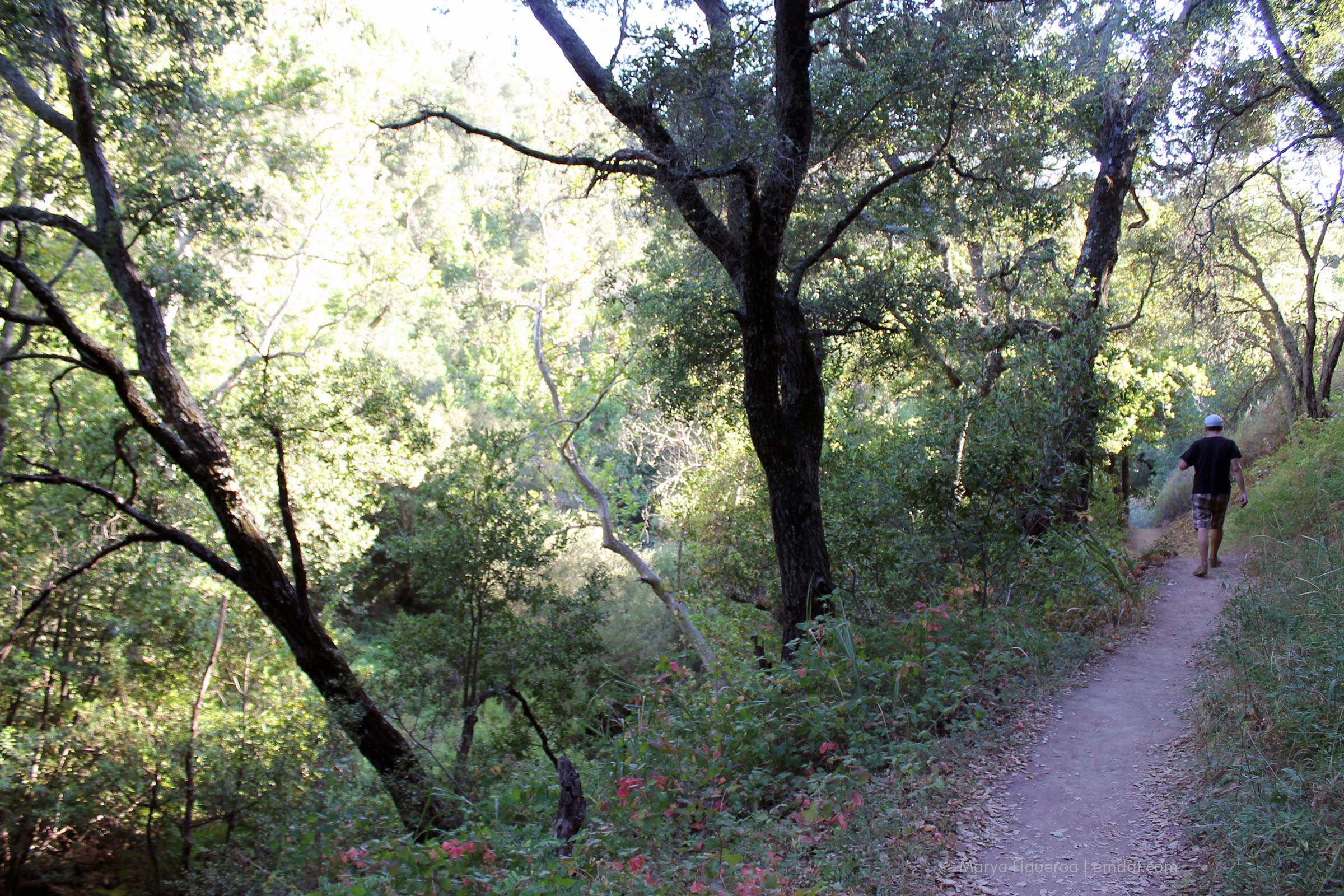
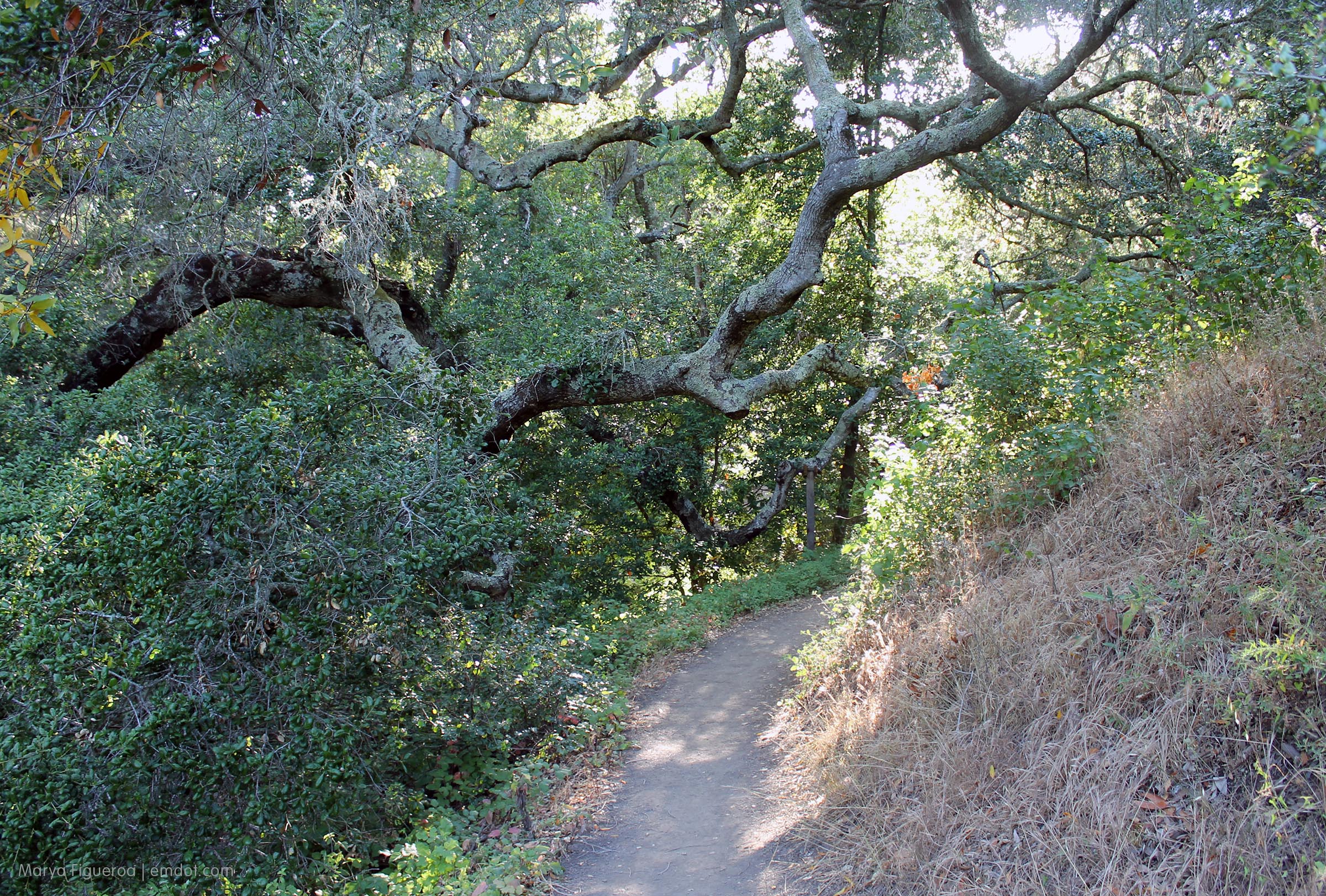
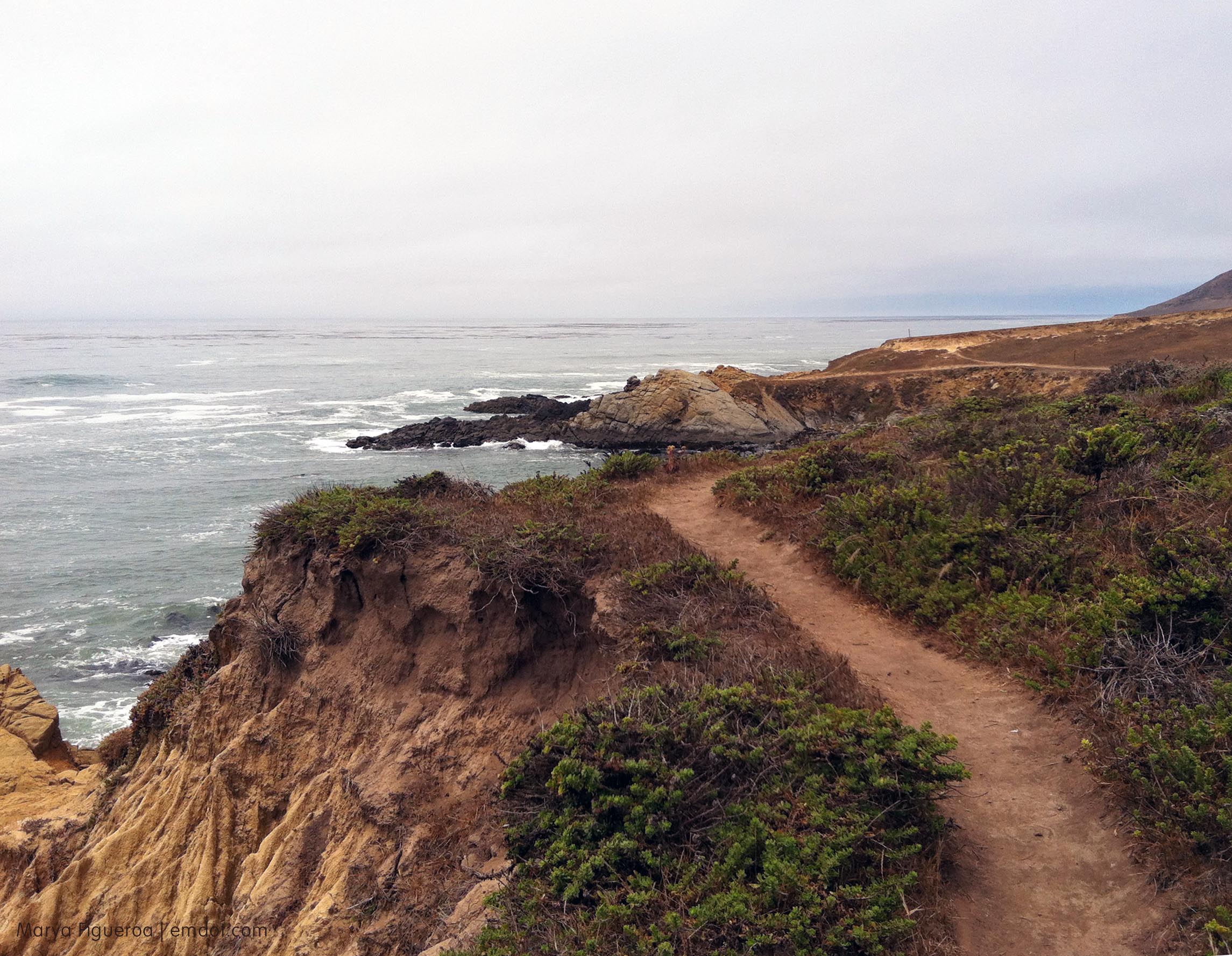
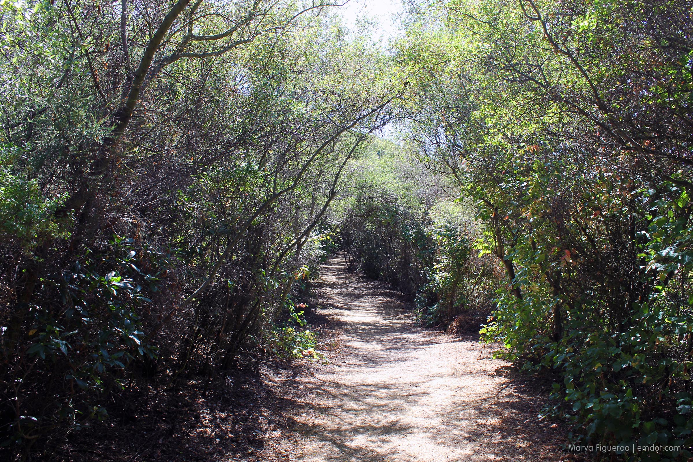
While the top of the trail is exposed, hot, and dusty, the trail closer to the campground is lined with tall trees and great shade. A welcomed return after you reach the top.

Cerro Alto

me on cerro alto


Harmony Headlands Beach

Harmony Headlands

With a nice long walk and a mile or so of rocky shore, we turned the Harmony Headlands trip into both Beach and Hike a Week.

cairns

The little dots of birds you see in the air are swallows and they were going crazy. They’ve built their mud nests into the cliffs and were darting and swerving and gliding and swerving and darting and charging all over the place.

cairns

The waves were huge, by the way. South swell (Killers seemed packed). We saw five or so guys out just south of the Headlands, too (as well as three walking back the path, coming from the north), but at this spot the waves crash too close to the rocks. We both took a ton of video. I’ll see if anything Steve took turned out. Mine didn’t match the awesomeness of the moment.

Steve taking photos

Harmony Headlands

Harmony Headlands

Harmony Headlands

harmonyheadlandsbeach


Harmony Headlands Hike

Harmony Headlands

Saturday, June 7, 2013. Harmony Headlands is between Cayucos and Cambria, and just two miles south of our county’s smallest town, Harmony (population 18). A 4.5 round trip easy walk, it’s a coastal access point along a desolate, rugged, lovely coastline previously only accessible if you were a rancher, a fisherman, or trespassing surfer.

Harmony Headlands hike

The hike is kind of divided in two: the first part is a well maintained, straight shot of a wide dirt path lined with hemlock, mustard, grasses and shrubbery. And then there are the dead trees. Three on one side (the middle one upturned and showing root) and three on the other (again, middle roots up). You couldn’t plan it better. Beautiful white skeletons holding steady in the fields.

Harmony Headlands hike

Harmony Headlands hike

Harmony Headlands field

Mustard

And then you reach this tree, can glimpse the sea and everything changes.

tree with view to ocean

ocean path

ocean path

ocean path

When we began to head back the sun came out. Perfect ending.

tree

path

I will admit that I thought this was anise. I was close; it’s in the same family as anise, but it’s poison hemlock. Sinister! Don’t go eating thinking you’ll get a licorice taste folks.

anise

peakaweek_060813


Poly Canyon | Week 11 | Peak a Week

Poly Canyon

Poly Canyon is part of the Cal Poly campus and consists mostly of a nicely maintained road lined with oaks, sycamores and chaparral, following a creek path on its north side. Towards the end of the road is the Design Village, a space where architecture students go out to build experimental structures. Each spring the space comes alive with new buildings, sculptures and other cool projects, but for the most part they come down at the end of April.

Some structures are more permanent and you can walk up to them, though are encouraged not to enter with “No trespassing!” signs and warnings of surveillance cameras. With the amount of graffiti inside, it seems as though not many follow the instructions.

Lovely walk and cool buildings. We spent much longer out there than we expected. Overall hike/walk is about 2.5 miles.

This spring/early summer there have been numerous mountain lion and rattlesnake sightings. Maybe because it is hotter and dryer than usual? This is the entrance to the area.

entrance

Hotter and dryer seems to work in the favor of poison oak, too. Look at that massive outcrop (it’s the red bit). Yikes!

poison oak

Still patches of flowers to be found.

flowers

Off the side of the road is the entrance to the Design Village.

Design Village arch

And a map of the different structures.

the route

The geodesic dome is cool and has an amphitheater inside. I think this would be a great place to bring your lunch during the work day if you work at Cal Poly.

geodesic dome

This structure echoes the dome motif, but obviously isn’t geodesic. More outerspace-ic. Ruin-ic. Cooleriffic. Mustardtastic.

spider building

The Shell House was my favorite and suffered the most from graffiti. Too bad. I vote for a Senior Project to clean it up. In fact, I thought it would be interesting to have senior projects to fix up several of the structures that seem to be headed for ruin.

Shell House

The inside of the Shell House. You can walk up stairs to a second floor. Someone did while we were there and my questions were “are you sure those are stairs and not shelves?” and “Are you sure that’s safe?” I kept my questions to myself.

Inside the Shell House

I am a sucker for a house that plays well with its natural landscape. Love this.

Another view of the shell house

Not sure of the name of this house, but I loved the stove pipes.

house

House

The sign to this structure said “Residential House” and it was unclear — did someone actually live in it? It seems like they could. The back side had a great metal-sign collage siding. Loved it. We didn’t linger, though, because it did feel as if we were in someone’s space although you couldn’t really tell if it was inhabited or not.

residential house

The beginning of June means the last green holdouts on the hillsides are losing their fight. Soon it will be all golden, all tan, all brown. All dusty. This last little bit of green was nice to see. (It was a nice, lush green run this year, I think.)

last of the green

More structures from the trail.

view from the trail

This cantilevered structure was really cool. I couldn’t find a name for it (I’ll have to pay more attention to signs next time I’m up there.). An abandoned pirate’s ship… in the middle of a sea of wild grass.

like a pirate ship

oak tree

peakaweek_060213


Cayucos Beach | Week 13 | Beach a Week

Saturday morning I headed up the coast to Cayucos, perhaps the last bonafide old-school beach town in California. I’d signed up for an embroidery class at Happy Go Smile, a cute new shop down town and across the street from the beach. Cool location, cool shop, cool proprietors.

Also nice: sitting around a table with a friendly group of ladies well equipped with needles, floss and hoops. Bonus points: Cupcakes from Amy Bakes right smack dab in the middle of the table, just there for the taking. Amy was also the teacher of the workshop. Barb, Chief Happy Go Smiler, was also there, making everyone feel welcome (and talented).

Happy Go Smile

After the class I grabbed a coffee from Top Dog, bought a new beach blanket from Good Clean Fun and headed out to the beach. It was a big walk across the street. God love Cayucos.

Cayucos

Lifeguard stand

Water temp: 55

I have a soft spot for the Cayucos Pier (and/or all piers, but especially this one). At its base is the Vets Hall which hosts everything from Gem shows to reggae concerts. When I was in high school we had a formal dance here and it was really great. You could dance all you want and then go walk out along the pier in between songs. We were lucky kids.

During the day the pier is filled with a handful of fisherman and a smattering of beach goers.

Cayucos pier

Cayucos pier

Cayucos pier

Cayucos is small. The town proper isn’t even a half-mile wide and only a couple miles long. Once you leave town heading north it’s really just open road and beaches ’til you get to Cambria. Maybe a house here and there, but more sand and surf than homesteads.

Looking north along the coast

Looking east, north side of the pier.

North side of the pier

Looking east, south side of the pier.

South side of the pier

And this is looking south towards Morro Bay.

beachaweek_060113_9southside

In the summer time Cayucos fills with people from the Valley (and by Valley I mean San Joaquin Valley). The people of Taft, Tulare, LeMoore, Bakersfield, Fresno, Hanford — these people need respite from the heat and they seem to choose two destinations: Pismo Beach or Cayucos. Both probably double in size in half-ton trucks alone.

But in winter and spring the place is still a local’s paradise. These kids running around really reminded me of what it’s like to be a Central Coast kid.

eatery

Waller color

The only part I don’t like about Cayucos is the sand-near-the-wall space. Maybe this is the space where people build bonfires? It gets a bit dirty and the kids draw kind of lame graffiti with the left over charcoal (sorry kids; no offense; I’m sure your graffiti abilities will get better.). And okay, truth be told, I really like the splash of color above and the tribute to our feline overlords below.

charcoal graffiti

beachaweek_060113


Valencia Peak

Monday, May 27th was Memorial Day and day one of my new workout regime. For the last few months I’d been walking a ton (hello FitBit), hiking once a week and a zumba class here and there, but no real work outs. It felt like it was time. So Monday I started a bonafide workout regime including lifting weights and the Couch to 5K jogging plan.

I did both Monday, which would you think would be enough. And then I hiked Valencia, a 3.7-mile round-trip hike with a 1275-foot climb (not much, but more than the other flat “hikes” I’d been doing lately). The next day my muscles were not happy with me, but that’s okay. I knew they’d recover.

valenciapeak

Valencia is one of the peak trails in Montana de Oro. The trail begins directly across the street from the Bluff Trail (featured here a bunch). 2+ miles one way, mostly gradually up. It’s less travelled than the Bluff trail, so you have more chance of running into wild life.

We didn’t see any of the following. Except for the poison oak. We saw a lot of poison oak. And while we didn’t see a rattle snake, we did see a garter snake (photo to come.)

peakaweek_052713_2danger

The trail, about a third of the way up. It temporarily opens wide and then quickly goes back to single-track-ish.

peakaweek_052713_4wideswath

Everything is blooming. Monkey flower, lupin, indian paintbrush, California buckwheat and a ton of other plants I can’t identify.

peakaweek_052713_5flora

My mom led the whole way (here we’re turned around so it looks like I’m in front, but you know who the real trail boss is).

peakaweek_052713_7meandmom

The lovely California Buckwheat.

peakaweek_052713_buckwheat

About halfway up, looking towards Morro Bay (aka due north). It was hazy, foggy, clear, windy, and chilly at alternate times.

peakaweek_052713_8tomorrorock

Flowers everywhere.

peakaweek_052713_9flowerhillside

The higher we went, the windier it got. It was the kind of wind that hurts your ears, so hats and hoods came in handy. Mom’s hood inspired her to re-enact the hooded monks we’d seen in MdO a couple months before. (Aside: we later found out that video was for English musician James Blake, shot entirely in the park).

peakaweek_052713_11hoodedmonk

Looking out towards the ocean. Steep hillside.

peakaweek_052713_13hillside

Here is the garter snake. Little guy. Garter snakes are pretty. He slithered away before I could get a decent shot.

Garter snake

Nearing the top. Still with the wildflowers.

peakaweek_052713_18pathandbuckwheat

We made it! And it was chilly and windy and we only stayed up there for five minutes or so.

peakaweek_052713_15top

peakaweek_052713_17hooded

And here is the James Blake video. If you watch ’til the end you’ll see the monks as well as Valencia Peak itself (right over his shoulder, on the left).

See all the photos in this flickr set

peakaweek_052713


Shell Beach | Week 12 | Beach a Week

Century Plant

Sunday we met Tom and Cami at Zorro’s Cafe in Shell Beach. For those of you who don’t know, Shell is a little, itty bitty beach town just north of Pismo Beach. Mostly residential, the short streets run perpendicular to the beach — just a couple blocks long (if), lined with little beach cottages, no sidewalks and signs that remind cars to slow down.

We had a 30-minute wait for a table to open, so we walked down to the beach.

Shell Beach

Shell Beach

Shell Beach

Steve at Shell Beach

Shell Beach

Most of the houses are traditional cottages, but some are big and fancy and some seem abandoned.

This house had a “lawn” of horsetail. So weird! And seemingly abandoned (but who knows).

The massive horsetail front "lawn"

And this house had a tree so large and old it seemed to be growing right into the house itself.

The tree that ate the house

Zorro’s is a locals’ favorite. There’s almost always a wait.

Zorro's

And it’s often chilly. This day was no different. Steve, Tom and Cami each had a sweater or jacket. I’d left mine in my car, but no worries: Zorro’s has Mexican blankets customers can wrap around themselves as they eat out on the patio. I took advantage. Very cozy.

The blanket

Tom and Cami will be having a baby any day now. Very excited for them. Also excited we got to spend a little bit of time with them before their whole world changes.

The friends

me, week 12

Coronado | Week 11 | Beach a Week

I was in San Diego for a conference and thought that it posed a pretty good opportunity to get to a beach outside my county. In fact, I had grand plans: beaches, hiking, beaches, hiking… I would make the most of my time in the Southernmost part of the state.

But what really happened is that my brain was so wiped out for learning learning learning during the conference day that all it wanted to do was hit the hay the moment I got back to my hotel room.

Monday, at least, we ventured to Coronado Beach (recommended by my friend and fellow-conference goer and fellow-San Diegan, Liana). By the time we got there it was approaching sunset, but you’d never know because the fog had come in.

Regardless, it was a pretty beach and a pretty evening and I was pretty happy to be there.

Coronado Beach

Coronado Beach

For those of you who don’t know, the red-roofed building is the Hotel Del Coronado (built 1885, Queen Ann style). People call it the Hotel Del. It’s huge and grand. Do read the history if you are interested.

Coronado Beach

The no sign

beachaweek_052013_9hoteldel

Gull

Gull flying away

Sand castle

This little guy befriended me pronto. I didn’t mind one bit as he was (obviously) cute as a button with a little personality to match. Plus, he gives some perspective to the size of the sand castle.

Sand castle and my little munchkin friend

Party at the Hotel Del

Hotel Del, night time

Me, Beach a Week 11

McWay Falls, Big Sur | Week 9 | Peak a Week

My mom and I have a semi-ritual (meaning we usually do it, but if it doesn’t happen we are okay, too) of driving up to Big Sur for both of our birthdays. We’ve been doing this since I was about 18 years old. That’s a long time, people.

May is my mom’s birthday month, so up the coast we headed. I was excited to take her to McWay Falls in the Julia Pfeiffer State Park because even though we’ve been to Big Sur many times, I knew my mom had never seen the Falls.

We could have gotten on the trail closer to the road, but I think entering the trail from the tunnel makes a much bigger impact.

The tunnel to McWay Falls

And what a beautiful view it is. You have to wander the well-plodded trail a few hundred feet till you see it, but when you do…

McWay Falls

After wandering the homestead/waterfall trail, we took it a bit south towards a hidden campground. This hike can barely be called a hike — it’s short; in fact it is shorter than short, but hike it is (all the maps and guidebooks say so.)

Hiking behind McWay Falls

The campsite is really lovely. Really beautiful. And really not protected at all from any stranger just walking through it to get a view. I asked one of the guys camping here (I asked him on the trail, not at his campsite) how it was camping here with all kinds of other travelers just tromping through his campsite. Not great, he admitted. Too bad, because what a location.

McWay Falls campsite

We continued the trail south. These signs… they are like little beckoning fingers to me. Come closer come closer. I use much resistance to stay away. Mostly.

No no no

The beautiful view looking south. Can you see the flat-roof house in the trees? What a life.

Big Sur coastline

Because I’m still in love with the black sage, I share with you some Black Sage in Big Sur.

Sage and bee

Black sage

I don’t know what this is and the picture is completely out of focus and yet I still love it.

Little flowers

McWay Falls is only one part of this hike. It is really just a part of the Julia Pfeiffer State Park. There are a few little meandering paths you can take.

Fire hose

Afterward McWay Falls we jumped back in the car to continue to drive north. Our destination would be Nepenthe for a late lunch and pie and the Phoenix Bookstore for browsing and creative dreamings.

It was my mom's birthday

Nepenthe

We got a ledge seat looking directly west. Lovely.

The view from Nepenthe (direct west)

The birds were out in full force. We are used to the crazy Stellar Jays and their crazy Jay ways. But this day our entertainment was provided by a lovely male Acorn Woodpecker…

Woodpecker in the tree

… who wanted our food …

Our food

… and was successful in getting several french fries from us.

The woodpecker

Week 9

Moonstone Boardwalk | Week 10 | Beach a Week

May 12, 2013 (Mother’s Day). My mom and I headed out to walk the boardwalk along Moonstone Beach.

cambria

Moonstone flowers

Guy lounging on Moonstone Beach

Moonstone

At one cove there were a dozen or so seals, including pups. Nursing pups!

Harbor seals

Harbor seal -- mother, baby, nursing

leave the seals alone

The flowers were in going strong.

flowers at moonstone

flowers at moonstone

flowers at moonstone

Moonstone

iris sign

This guy was out at the end of the northern most point of the boardwalk after fish-kayaking. What you can’t see are the 25 seagulls behind him, waiting for the fling of fish carcass in their direction.

cleaning fish

cleaning fish

The squirrels at Moonstone are both well fed and fearless, a dangerous combination. Or cute-as-hell combination. Perhaps both.

squirrels lined up

tag team

on the railing

me, week 10, beach a week